Larnaca International Airport (LCA)
Orientation and Maps
(Larnaca, Cyprus)
The island of Cyprus is made up of six individual districts and lies in the eastern region of the Mediterranean Sea. Nicosia is the capital of the island and can be found on the northern side of the central area, with the other five districts being Ammochostos, Keryneia, Lemesos, Pafos and Larnaca (Larnaka). Located on the eastern side of Cyprus, Larnaca lies to the south-west of Famagusta and north-east of Vasilikos.
Larnaca is home to the main airport on Cyprus and has a population of more than 70,000 locals. The busy Larnaca International Airport (LCA) is located close to a prominent port. Larnaca Airport is considerable larger than the island's other airport and can be found next to the Salt Lake. The city has become a major tourist resort and features sandy beaches which stretch for 25 km / 16 miles.
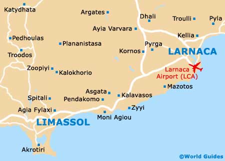
Larnaca International Airport (LCA) Maps: Important City Districts
Within Larnaca town, a number of interesting archaeological sites are amongst the highlights, with the Ancient Kitium ruins being unmissable. Around the city centre are six popular museums, all of which are within walking distance of each other and close to plenty of local shops. Further attractions here include cinemas, seafood restaurants and charming tavernas.
Many of the island's most popular hotels line Larnaca Bay and are conveniently located for those intending to explore the rest of Cyprus. Nearby, the Hala Sultan Tekke mosque is worthy of a look and lies to the west.
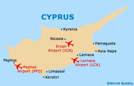
Cyprus Map
Larnaca Map